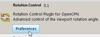
Rotation Control

1. What and Why
Rotation Control Plugin (RotationCtrl-pi) allows the user to control the way the chart is shown on the the computer-screen.
A. What RotationCtrl can do
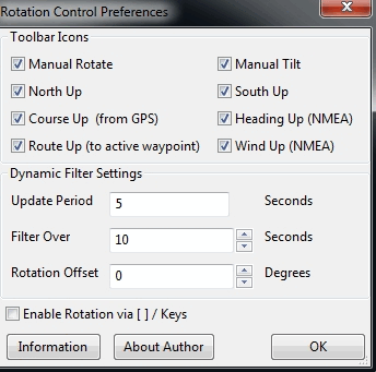
You can rotate the chart manually (clockwise, counterclockwise) and in the following manners:
-
North up (the top of the chart corresponds to the direction of true North).
-
South up (the top of the chart corresponds to the direction of true South).
-
Course up (the top of the chart points corresponds to the direction you are actually goïng (Course over Ground).
-
Heading up (the top of the chart corresponds to the direction you are steering).
-
Route up (the top of the chart corresponds to the waypoint that is activated as “navigate to”.
-
Wind up (the top of the chart corresponds to the direction the wind is coming from).
The plugin gets the necessary information in the following ways:
-
about “North“and “South”: from the information in your digital charts.
-
about your course: from your GPS.
-
about your heading: from your (electronic) compass that outputs NMEA-data to OpenCPN.
-
about your route: from OpenCPN (when you have activated a route).
-
about the wind: from your wind sensor that outputs NMEA-data to OpenCPN.
B. Why Rotation-pi can be useful
Normally the representation of a chart is “North up”.
That means Top is “North”, Right hand side is “East”, Bottom is “South” and Left hand side is “West”.
But maybe you prefer to have the top of the chart corresponding to “South”.
Or to have the top of the chart corresponding to:
-
your present course (to where you are really going to)
-
or heading (to the direction your bow is pointing to)
-
or route (to where you are supposed to go)
-
or the wind-direction (the direction to avoid facing while throwing up or peeing).
Examples:
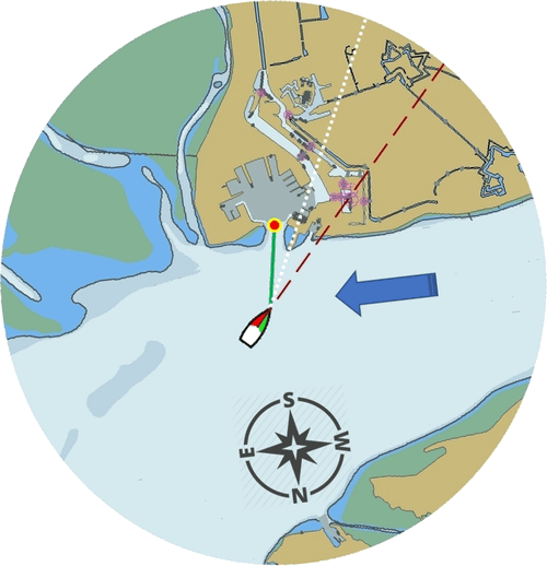
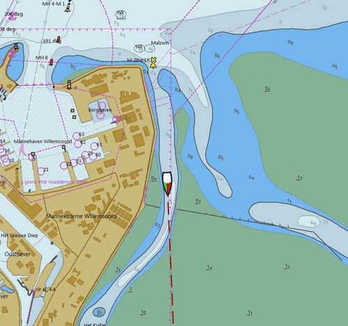
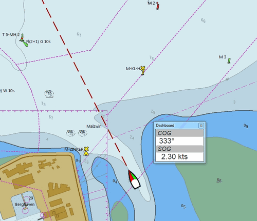
This sailing vessel is inward bound. The representation is “North up”.
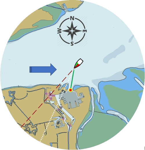
-
The wind (blue arrow) is from the West.
-
The ship’s heading is the red dashed line.
-
The ships course (over the ground) is the white dotted line.
-
The ships route (next active waypoint) is the red dot at the end of the green line (and don’t worry, she’s just about to turn to port).
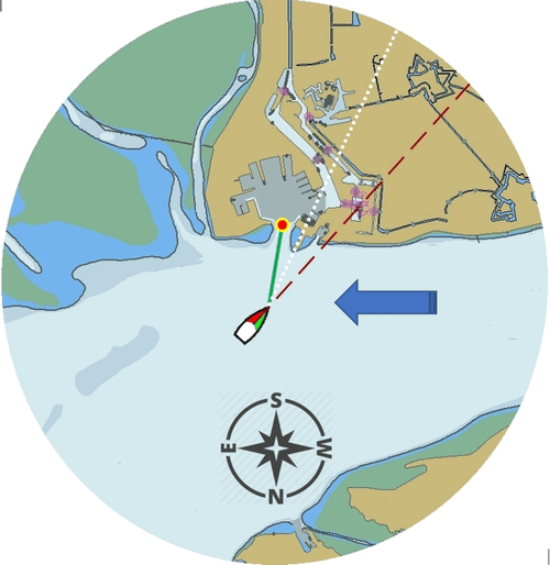
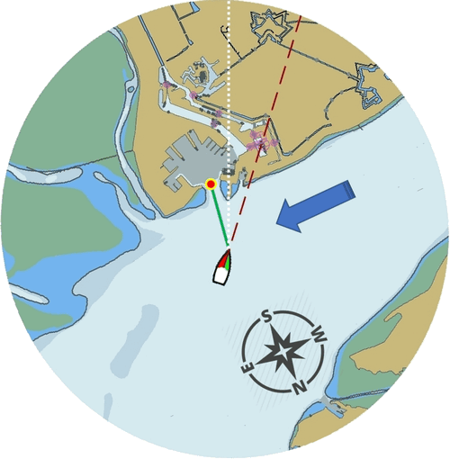
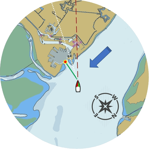
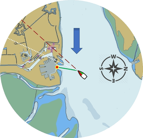
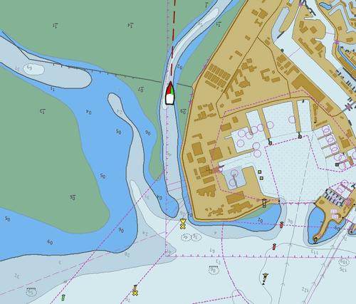
The next illustrations show you the differences. Note the rotation of the coastline.
South up
Course up
Heading up
Route up
Wind up
2. Installation
The OpenCPN Manual has general information in Plugin Download, Install and Enable for installing this plugin. This is the preferred way.
Rotation-pi can also be downloaded from https://opencpn.org/OpenCPN/info/downloadplugins.html and installed with a Legacy Pl Package.
Don’t forget to enable the plugin.
The Rotation-pi icons should appear in your Toolbar.
4. Standard Actions
What are basic (standard) actions you have to do to make Rotation-pi
work.
Simple: just click the button of your choice to activate the desired
rotation.
Note: the buttons for “Manual Tilt” (the red buttons) do not seem to
work yet!
To go back to the normal representation (“North up”) click the “North
up”-button.
5. Remarks
A. Why (or why not) "North up"?
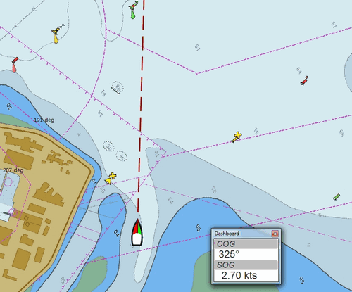
This is the “normal” representation (“North up”).
We are sailing in a narrow channel in a southerly direction.
On the chart, the coast is on the left side of the boat-icon.
But for the helmsman on board the coast is on his right hand
(starboard) side.
For someone who has a clear visual image of the chart “in his head”,
this should not be a problem.
But other people may find it a bit confusing.
This is the same situation, but now with “Heading up”.
In this presentation-mode the chart shows the coast on the same side
(right hand) as it is seen from the helmsman’s position.
That sounds logical.
But for those of us who have “the chart in their head” it can be
confusing.
(because the brain may say “Hey skipper! It’s your boat that is moving
and turning, not the coast!”)
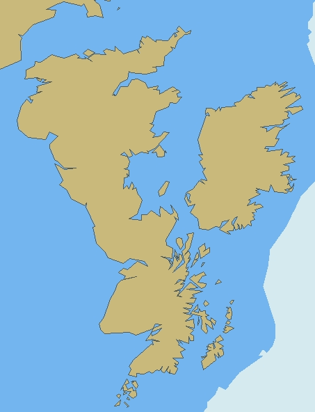
Let’s face it: when thinking of the UK and Ireland,is this what you have in mind?
B. Notes on possible strange behavior of ENC-text
When using ENC-charts (vector-charts) you might experience some weird behavior when using any other mode than “North up”.
This is “North up”
Note the ENC-text for the names and numbers of the buoys and the indication “Wk” on the wreck-symbols.
And a few seconds later, but now with “Heading up”.
Note the icons for the buoys are not “upright” anymore, but also rotated (and with “South up” they would be completely upside down).
But more disturbing is that the ENC text for the names and numbers of
the buoys has disappeared (as has the text “Wk” on the wreck-symbols).
And other ENC-text might be placed in the wrong positions.
This “missing text-bug” can occur because in this example a ENC (a
vector chart) is used.
It can occur with all representations that are not “North up”.
Note: This does not seem to occur to all ENC’s, but it can occur.
It can not happen while using a raster chart (on a raster chart you will
not lose the text, but the text will be rotated the same way as the rest
of the information on that chart).
C. Notes on strange interaction with Google Earth
When used in conjunction with the Google Earth-plugin, something
strange happens. In any representation-mode other than “North-up” or
“South-up”, the picture in the Google Earth-window rotates
opposite to the rotation of the main screen (the chart).
In other words, if the main charts rotates clockwise, the Google
Earth-window rotates counter-clockwise and vice versa.
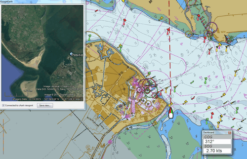
True, it does make navigation more interesting, but nevertheless should be considered a bug in this
D. Notes on possible performance-issues
When you alter course, something happens on your OpenCPN screen. In normal mode (“North up”) OpenCPN rotates your ship’s icon. But in modes “Heading up”, “Course up” and “Route up”, you want OpenCPN to rotate the world. That takes a lot more than just rotating that ship-icon. On less powerful systems it might cause the system to respond slower than desired (or it might cause other problems).