Vfkaps Charts
Links
-
Source: Github Repository
-
Releases: Github Releases Download
-
Download: Download Webpage
-
Website: VentureFarther.com
-
Forum: https://forums.ybw.com/index.php?threads/google-earth-kap-chart-creation-plugin-for-opencpn.484796/
1. What and Why
In some areas of the world a satellite chart is more accurate than even the official chart. This plugin allows satellite charts from Google, Bing or Nokia to be downloaded via the VentureFarther server https://www.venturefarther.com
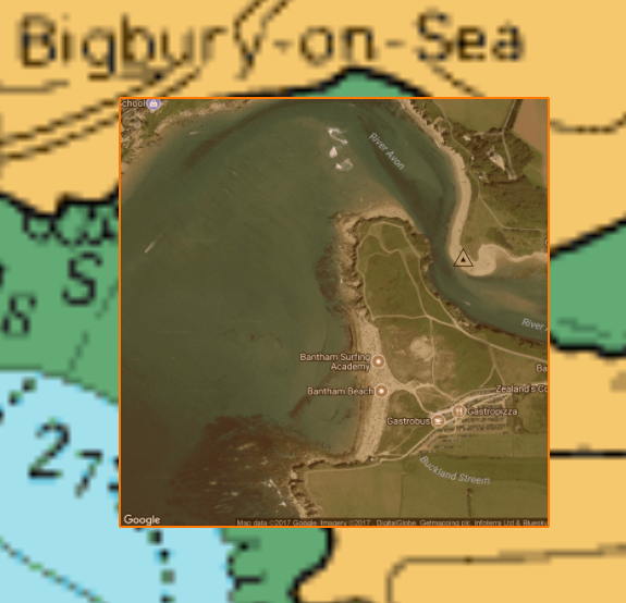
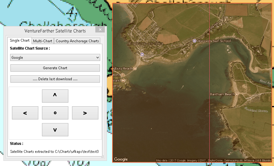
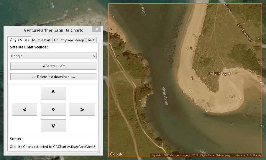
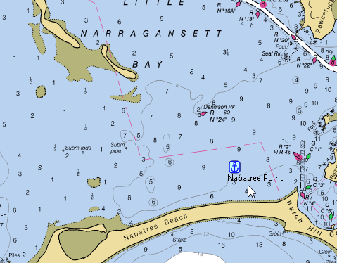
Even in well charted areas such as the UK the satellite chart will often be more accurate than the official UKHO chart. As an example a waypoint was made on the chart for the River Avon, Devon, UK.
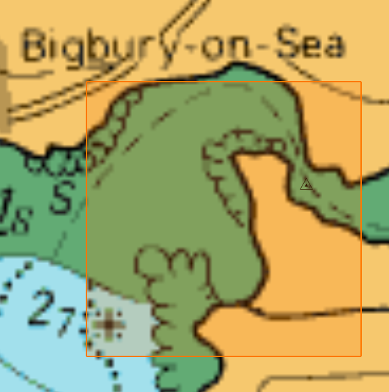
An extreme example but the satellite chart shows where you could have ended up if you had followed the navigation chart!
2. Install
You will need to register with VentureFarther and obtain your API key here
Please read the 'Credits' page on the VentureFarther website. 1 Credit is used for each single satellite chart download. Making a 'Multi-Chart' download will use 9 credits, because it consists of 9 satellite charts. Credits can be earned by submitting cruising information or you may choose to purchase an annual subsciption.
Download the plugin installer and run the installer .exe file from here (Windows):
On Linux download the DEB package and install this.
Important … Using encrypted charts while using the plugin
If one of your 'normal' navigational chart directories contains encrypted charts, such as those from VisitMyHarbour you will find that any satellite charts you create are deleted as soon as OpenCPN is closed. To avoid this you will need to remove the encrypted chart directory.
Close OpenCPN and restart. Make your satellite charts. You can then close OpenCPN. VisitMyHarbour (VMH) charts are activated … 'I agree'. Start OpenCPN and add your VMH chart directory. You then have both satellite charts and VMH charts on the same screen. You will be able to create more satellite charts in this state but they will be deleted as soon as OpenCPN closes.
3. Standard actions
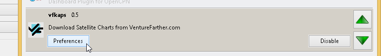
Open the toolbox and enable 'vfkaps'. Open 'Preferences'.
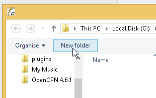
Select/create the directory where you want to save your satellite charts.
Enter your VentureFarther API key.
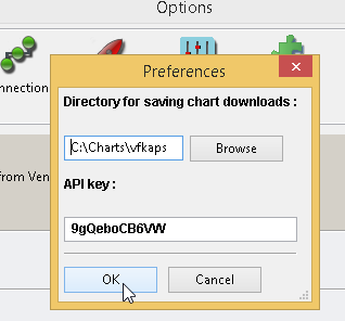
Apply/Ok and on the toolbar you will find the vfkaps icon.
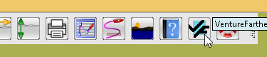
Start the vfkaps plugin.
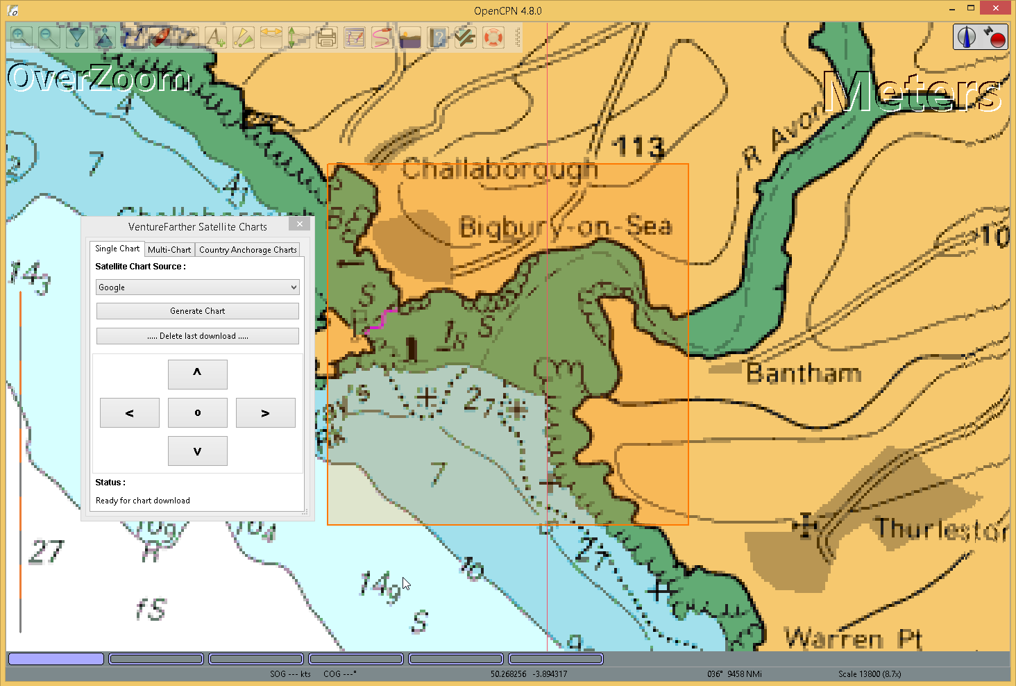
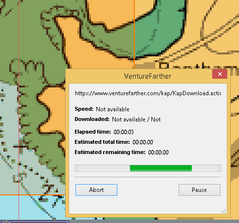
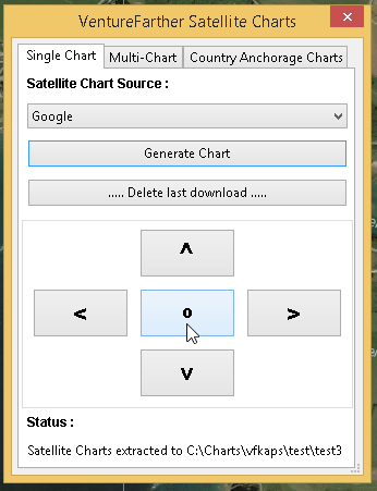
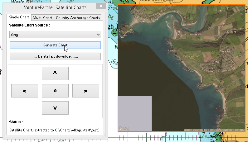
Using the orange box as a 'gunsight' move to the area of the chart where you want to download a satellite image and press 'Generate Chart'.
A dialog box will show the progess of the download.
You can zoom in and use the new selected area to make a larger scale chart.
Use the arrow keys to move to an adjacent area.
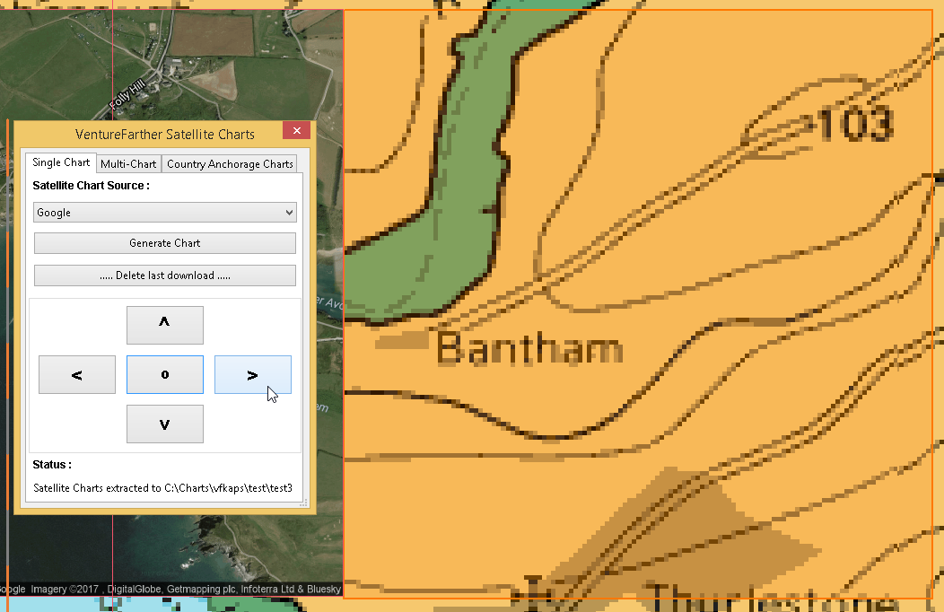
And you can download the satellite chart for that area.
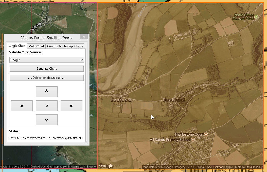
After using the direction arrows you will need to use the 'O' button to re-centre the orange box in the centre of the map.
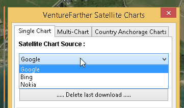
A different provider for the satellite chart can be chosen but if the same area is used the first downloaded chart will be overwritten and lost.
Format of the satellite chart
Country_VF_latitude_longitude (degrees, decimal minutes)
United_Kingdom_VF50_16.794_N_3_52.806_W.kap
4. Options / Warnings / Ideas
Sharing anchorage information
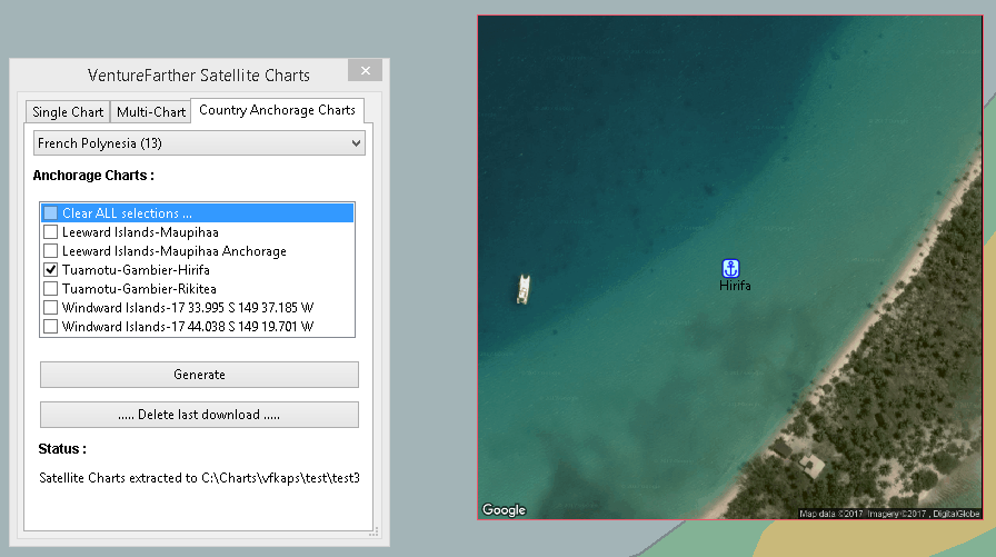
One of the aims of VentureFarther is to help sailors share information about the anchorages they use. On the VentureFarther website you will find anchorages that users have contributed. Satellite charts of these anchorages can be made by using the 'Country Anchorage Charts' tab of the plugin.
Using this tab generates a list of countries for which users have contributed an anchorage. Select the anchorage area of interest. 'Generate' will create the satellite chart and place a waypoint icon near the anchorage. The normal warnings apply about using the best information available to determine the safety of the anchorage you have chosen.
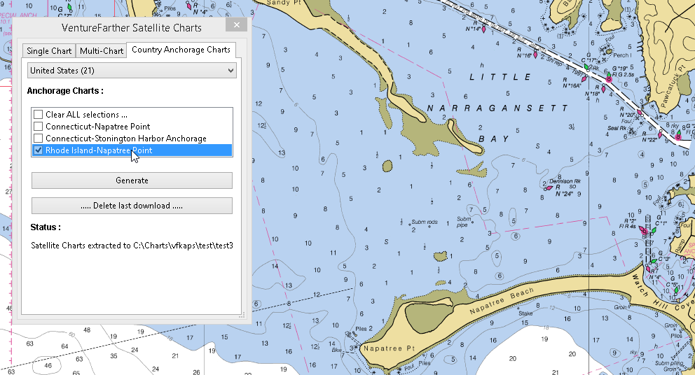
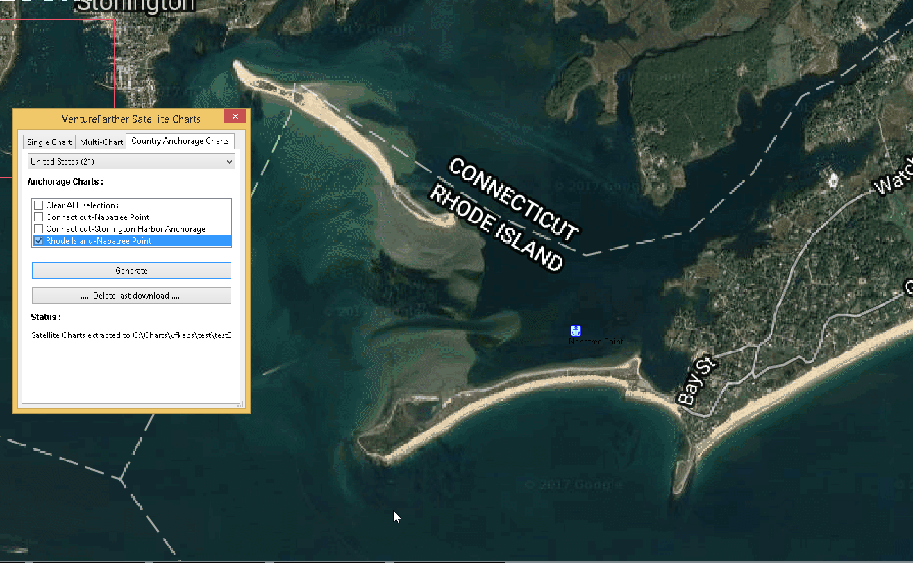
These anchorage satellite charts may be especially useful in poorly charted areas of the world.
3. Standard actions
Open the toolbox and enable 'vfkaps'. Open 'Preferences'.
Select/create the directory where you want to save your satellite charts.
Enter your VentureFarther API key.
Apply/Ok and on the toolbar you will find the vfkaps icon.
Start the vfkaps plugin.
Using the orange box as a 'gunsight' move to the area of the chart where you want to download a satellite image and press 'Generate Chart'.
A dialog box will show the progess of the download.
You can zoom in and use the new selected area to make a larger scale chart.
Use the arrow keys to move to an adjacent area.
And you can download the satellite chart for that area.
After using the direction arrows you will need to use the 'O' button to re-centre the orange box in the centre of the map.
A different provider for the satellite chart can be chosen but if the same area is used the first downloaded chart will be overwritten and lost.
The section deleting the last chart download shows how to delete files from the last download
Format of the satellite chart
Country_VF_latitude_longitude (degrees, decimal minutes)
United_Kingdom_VF50_16.794_N_3_52.806_W.kap
4. Options / Warnings / Ideas
Sharing anchorage information
One of the aims of VentureFarther is to help sailors share information about the anchorages they use. On the VentureFarther website you will find anchorages that users have contributed. Satellite charts of these anchorages can be made by using the 'Country Anchorage Charts' tab of the plugin.
Using this tab generates a list of countries for which users have contributed an anchorage. Select the anchorage area of interest. 'Generate' will create the satellite chart and place a waypoint icon near the anchorage. The normal warnings apply about using the best information available to determine the safety of the anchorage you have chosen.
These anchorage satellite charts may be especially useful in poorly charted areas of the world.
Insufficient credit with VentureFarther
If you have run out of credit with VentureFarther you will get a warning notice.
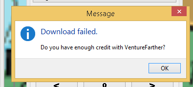
You will need to increase your credit with VentureFarther by making a contribution to the data on that website. You may wish to purchase an annual subscription.
Chart directory has been deleted
If you have deleted the directory where you have been saving the charts you will get a warning.
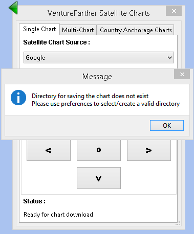
You will need to go back to preferences and select/create a new directory.
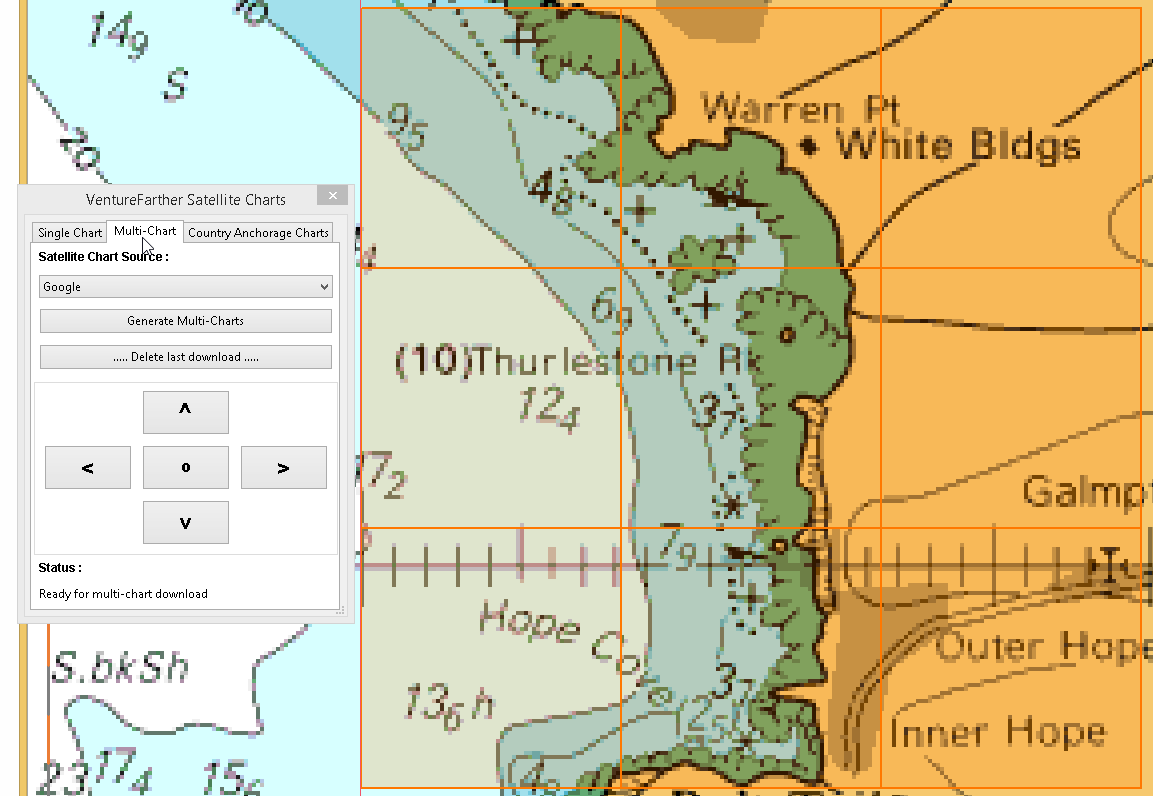
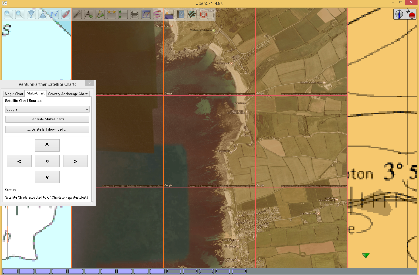
Tiling satellite charts
This is carried out by using the 'Multi-Chart' tab.
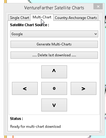
Use the direction arrows to select the centre of the 9 charts that will be downloaded.
Be prepared for a large download, that can take several seconds.
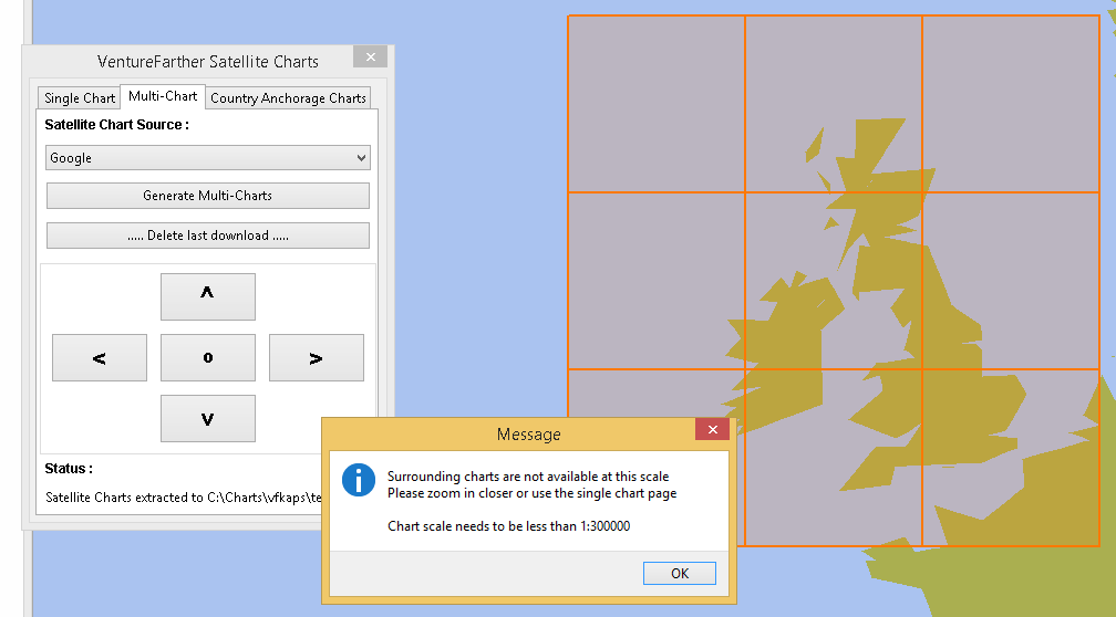
Surrounding charts at very small scale
Single chart downloads at very small scale is possible. You will not be able to download the surrounding charts using 'Fetch surrouding charts'.
Deleting the last chart download
Use the button 'Delete last download'.
This option is useful if you want to compare the satellite chart of the same area from different providers.
And the last chart files will be deleted.
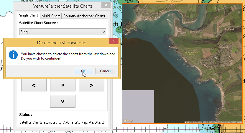
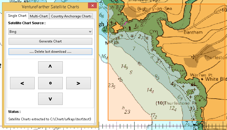
Chart directory has been deleted
If you have deleted the directory where you have been saving the charts you will get a warning.
You will need to go back to preferences and select/create a new directory.
Tiling satellite charts
This is carried out by using the 'Multi-Chart' tab.
Use the direction arrows to select the centre of the 9 charts that will be downloaded.
Be prepared for a large download, that can take several seconds.